Brett Engstrom, Consulting Botanist and Ecologist, May 15, 2015
Report Overview
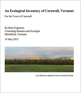
Click to download the full report
Initiated by the Cornwall Conservation Commission, the objective of this inventory was to find and describe areas of highest ecological value in Cornwall. It was completed by Brett Engstrom, Botanist and Ecologist, and took place from 2013 to 2015. His primary focus was to identify natural communities of state and local significance, species of greatest conservation need, large and more intact forest blocks, riparian areas of special importance for watershed health, and potential connectivity habitat.
Engstrom notes that Cornwall is uniquely rich in valley bottom silt and clay soils, extensive floodplain wetlands, and limestone ledges, all due to its location in the bottom of the Champlain Valley. During the fieldwork phase of the inventory, of the 17 natural sites visited, 13 were found to contain state-significant features: that is, they had at least one natural community of state-level significance or a species of conservation importance on the state level.
Multiple occurrences of state-level significant mesic maple-ash-hickory-oak forests, transition hardwoods limestone forests, and clayplain forests were documented. Thirty rare, threatened, and/or endangered species (21 plants and 9 animals) are now known in Cornwall. This includes all the rare plant and animal species known prior to the inventory, plus 10 new plant species that were discovered during 2014 field visits.
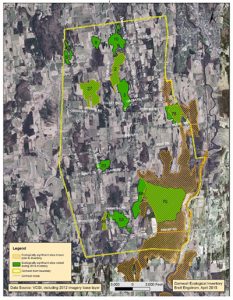
Click to view larger map
The 13 state-significant sites are described in detail. He indicates that their importance is further enhanced by the fact that they occur in larger and more intact forest blocks that also contain a variety of locally significant ecological features. “Intact” refers to areas that were forested in 1940 (based on aerial photographs), and thus were likely never (or only briefly) cleared for agriculture or pasture.
Using GIS analysis, two maps are included showing areas that could benefit most from improvement to protect water quality and provide flood hazard abatement. One map highlights areas with frequently flooded soils that are currently agricultural field or non-actively managed grassland. A second highlights stream segments needing forest buffers. A final map, produced through GIS analysis and augmented by wildlife observations by local residents, shows potential connectivity habitat between eight forest block and landscape districts in Cornwall and adjacent towns.
Also available are the following additional materials:
*Descriptions of site #29, #26, #25 and #36, Cornwall_NRI_extra_site_descriptions.pdf
* A spreadsheet containing information about all sites that were identified as having special natural features. Cornwall_NRI_sitelist.pdf
*A map of all sites on the inventory prioritized site list, Cornwall_NRI_map.pdf. For greater detail, a high-resolution image is available (10MB).